

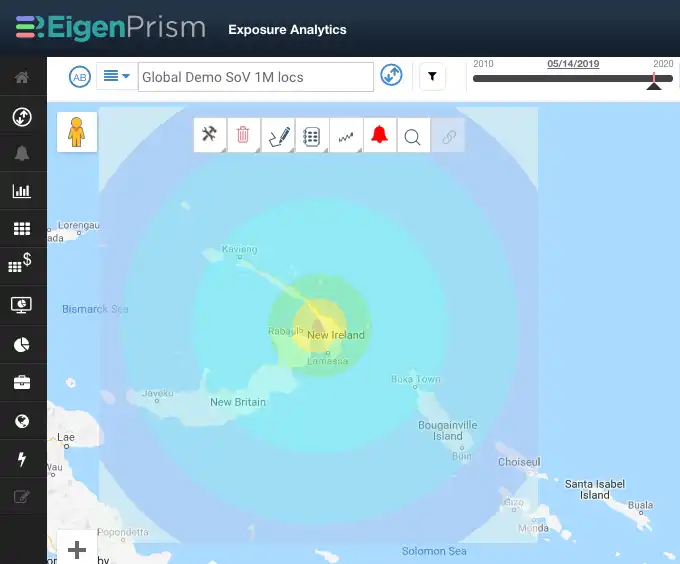
M 7.5 earthquake Papua New Guinea
A powerful M 7.5 earthquake struck Papua New Guinea and was felt in the nearby Solomon Islands. EigenPrism users can access the event footprint through this QuickLink; EigenPrism 3.0 beta users can use this link.
The USGS provided the following tectonic summary:
The May 14, 2019, M 7.5 earthquake in the New Ireland region of Papua New Guinea occurred as the result of shallow strike-slip faulting within the interior of the Pacific plate. Focal mechanism solutions for the earthquake indicate that rupture occurred on either a right-lateral northeast striking or a left-lateral southeast-striking fault. In this region, the Australia plate moves to the east-northeast with respect to the Pacific plate at a velocity of about 105 mm/yr. At the location of the earthquake, some researchers consider the edges of the Australia and Pacific plates to be divided into several microplates that take up the overall convergence between Australia and the Pacific, including the Solomon Sea, South Bismark, and Manus microplates near this event. In this context, the May 14th event occurred along the boundary between the South Bismark and Manus microplates. This fault structure was also the location of a M 8.0 earthquake in November 2000.
Assessing the impact
EigenAlerts provide automated notifications with key metrics to estimate impact:
- Customized and mobile enabled
- Updated as forecasts and advisories change
Subscribers who have set earthquake Alerts will receive email and text notifications detailing the estimated impact on their exposure. Quick links have also been provided to our customers.
Contact us if you want to use EigenAlerts immediately; you can be up and running in a day if you have data in standard cat model or spreadsheet format.
Arrange a live demo
Not a subscriber, but want to see how this works? Contact us and we’ll set up a live demo to show you how EigenPrism helps you plan, monitor and respond to nat cat events.
[wpforms id=”2114″]


