

Settling the Score on Wildfire Risk
Although the severe storms during the past few months in California and across the western U.S. may have a mitigating effect on potential wildfire exposures in some parts of the region during 2024, the threat persists in many areas of the country, given the likelihood of another summer of record high temperatures.
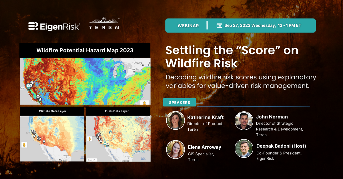
A recent webinar hosted by Deepak Badoni, president, EigenRisk featuring Teren, Inc. describes the latest methodology for assessing U.S. wildfire risk using a carefully constructed machine learning algorithm. Teren’s algorithm uses 14 explanatory variables to model wildfire exposures and assesses each variable for a given geographic location based on nine classes, with a rating of 1 being low risk and 9 being the highest risk.
John Norman, Teren’s Director of Strategic Research & Development, explained that climate variables evaluated in the model include temperature, annual precipitation, summer precipitation, vapor pressure deficit, evapotranspiration, and wind.
Topography variables include elevation, slopes, curvatures (convex or concave), solar factor, soil moisture, and topographic wetness potential. The model also considers fuel height and nine land-use classifications, which range from non-burnable wetland (lowest risk class) to forest (highest risk class).
In quantifying wildfire hazards for underwriting or risk management purposes, Elena Arroway, Teren GIS Specialist, discussed the Jimmy’s Waterhole Fire that occurred in 2023 in New Jersey. She noted that climate and topography in the area were not classified as high risk, while fuel height and land use (forest) were the most significant factors in the resulting fire.
Norman discussed the Hermits Peak Fire in 2022, the largest and most destructive fire in New Mexico, which Teren’s algorithm had accurately predicted. According to Teren’s algorithm, the area was in the 90 – 100 percentile for wildfire risk based on its dynamic non-linear assessment of explanatory variables. In this case, fuels (a dry coniferous forest) accounted for the highest risk classification, but the algorithm’s effectiveness stemmed from its ability to account for the interplay of multiple input variables given different conditions.
Badoni demonstrated how to use the EigenRisk platform to access Teren’s resources to score wildfire exposures associated with individual user portfolios or single locations, including the seamless ability to generate reports.
Katherine Kraft, director of Product at Teren, discussed new capabilities to be launched soon, including a probabilistic loss model to generate property-level wildfire damage estimates and expansion of its wildfire modeling to include Hawaii and Alaska.
Want to learn more?
To access the webinar, click here. To arrange a discussion and a demonstration of the Teren, Inc. wildfire modeling capabilities on the EigenRisk platform, contact us:


