

Tropical Cyclone Kirrily Slams Queensland Coast with Heavy Rains
Tropical Cyclone Kirrily, previously a category three storm, hit the Queensland coast, bringing heavy rain and wind gusts reaching 170km/h. The cyclone was initially downgraded to Category Two and then into Category One as it moved inland. The wind gusts also saw a downfall from 224 km/h. at Thursday afternoon to 82km/h by midnight.
Despite the downgrade, the cyclone will still bring strong winds and heavy rain inland. The Queensland premier, Steven Miles, earlier had requested federal assistance in anticipation of the cyclone’s impact and had also declared a disaster. A severe weather warning remains for areas further north, including Cairns and Port Douglas, with potential winds exceeding 100km/h.
As Kirrily advances inland, it carries a lot of moisture along with it. In the next 24 hours, isolated rainfall of around 300mm is anticipated, accompanied by a storm tide between Townsville and Mackay. The alert will stay in place until Friday morning.
Tropical Cyclone Kirrily Approaches Queensland Coast: Actionable Insights on EigenPrism
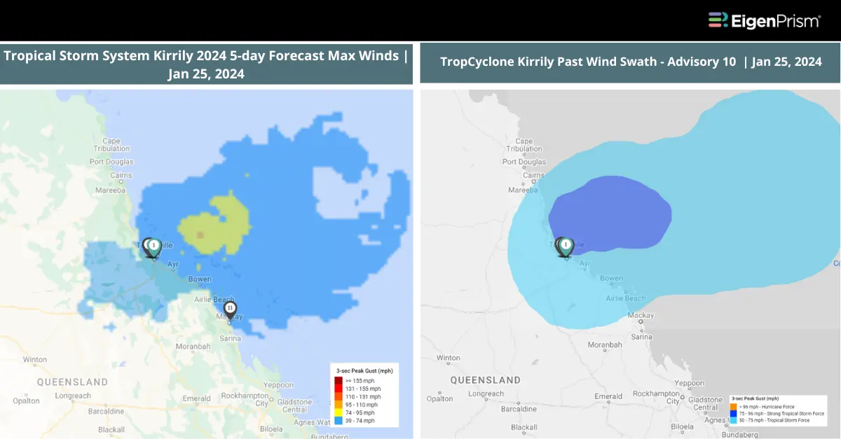
All EigenPrism® users can assess the post-event impact using the following event footprints:
Australia Tropical Cyclone Kirrily 2024 Post-Event Impact Report – Template
The report template auto-updates with the following latest available post-event footprints:
- Tropical Storm System Kirrily 2024 Past Max Winds from Adiabat
- TropCyclone Kirrily Past Wind Swaths from Hurricane Mapping
All EigenPrism® users can assess the forecasts using the following report template:
Wind
Australia Tropical Cyclone Kirrily 2024 Forecast Report – Template
This report template auto-updates with the latest available wind forecasts based on the following:
- TropCyclone Kirrily Forecast Wind Swath from Hurricane Mapping
- Tropical Storm System Kirrily 2024 5-day Forecast Max Winds from Adiabat
Flood
Australia Flood Forecast Report-Template
This report template auto-updates with the latest available flood forecasts based on the following:
- ANZ 3-day Flood Potential from Adiabat
- ANZ 5-day Flood Potential from Adiabat
Escape the News Cycle | Get Alerts Automatically For Events Impacting Your Assets
With EigenPrism Alerts, you can set Alerts and free yourself from constant event monitoring. Set up personalized alerts based on predefined impact thresholds and choose how you receive them – via email, SMS, or directly within EigenPrism. This way, you stay informed on your own terms, focusing only on the events that truly matter to your assets.
Set your alerts now.
Don’t have access to EigenPrism®?
Sign up for a trial account and access full impact reports of all events. Contact us and we’ll set up a trial account for you.


